A Working Vocabulary
A short field guide to the terms that change coastal design decisions, from reclamation and nourishment to sediment budgets, settlement, freeboard, and public trust.
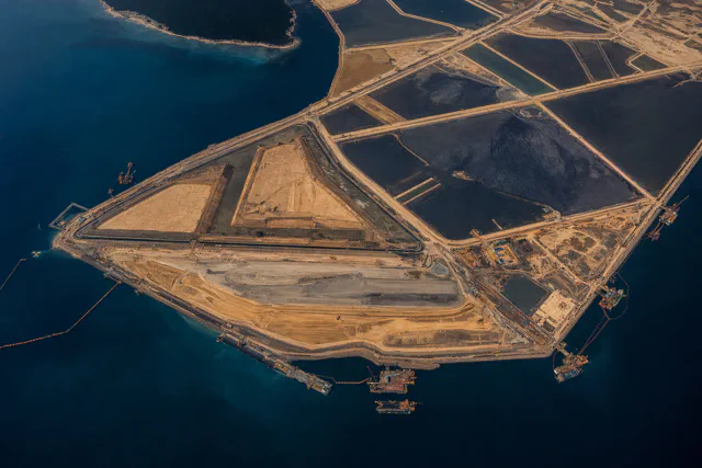
At a permit meeting, the word reclamation can describe two opposite acts. A port engineer may mean placing fill to create industrial land. A restoration team may mean returning a damaged wetland to ecological function. Both uses are established, and every later agreement depends on settling the meaning first.
This field guide collects the terms most likely to change a coastal design decision or expose a category error. Use it whenever a familiar word seems to carry more certainty than the evidence.
What is being changed
Reclamation means making usable land from an area that was submerged or intertidal. The method may involve hydraulic fill, perimeter dikes, caissons, rock, ground improvement, or a combination. In other contexts, especially environmental programs, reclamation can mean restoration. The intended meaning should always be stated.
Nourishment places compatible sediment on a beach or in the nearshore system to replace material that has eroded. It maintains a shoreline function. It usually anticipates future placement because waves and currents continue after construction.
Elevation raises existing land. It may protect buildings or infrastructure without moving the plan-view shoreline very far. Its central questions are foundation capacity, drainage, access, settlement, and the relationship between the raised parcel and the land around it.
Armoring uses hard structures such as seawalls, revetments, bulkheads, or rock to resist erosion or hold a fixed line. It can protect what is behind the structure while narrowing or eliminating the beach in front when the surrounding profile continues to retreat.
Beneficial use means placing dredged sediment for an intended productive purpose, such as beach nourishment, habitat construction, wetland support, or structural fill. It is a use category, not a material certification. Sediment still has to be tested for compatibility, contamination, engineering behavior, and effects at the placement site. The USACE Regional Sediment Management program treats sediment as a resource within a wider system rather than as waste to be removed from one isolated project.
What has to balance
A sediment budget is an account of material entering, leaving, and remaining within a defined coastal area over a defined period. The boundary matters. A beach can lose sand while the larger nearshore system retains it in an offshore bar. A regional budget can balance while one town erodes because a structure traps material updrift.
The tidal prism is the volume of water exchanged through an inlet during a tidal cycle. Changing the connected basin, opening width, channel depth, or flow path can change velocities and shoaling. The inlet functions as the throat of a moving water system, with every geometric change affecting the exchange through it.
Relative sea-level rise is the change in water level relative to the land at a particular place. It combines changes in the ocean with vertical land movement. National scenarios become usable design inputs only after local subsidence, uplift, datum, and project settlement are accounted for. The NOAA sea-level technical report supplies the scenario framework; site measurements anchor it to a place.
Settlement is downward movement caused by compression of the project fill or the soils beneath it. Subsidence is the broader lowering of the land surface, which can include groundwater withdrawal, oxidation of organic soils, tectonic movement, or regional compaction. A reclaimed platform can settle while the surrounding region also subsides. The two motions need separate measurements even when they add to the same elevation problem.
What level is being promised
Freeboard is elevation reserved above a reference water or design level. It accounts for uncertainty and performance requirements. Its value depends on waves, surge, settlement, consequences of overtopping, drainage, and the use behind the edge.
A design event is the loading condition selected for analysis. It may be expressed through an annual exceedance probability, a historical storm, a synthetic storm, or a combination of conditions. A 1 percent annual-exceedance event carries a 1 percent chance of being exceeded in each year. Under a stationary assumption, the chance of at least one exceedance over one hundred years is about 63 percent. The familiar “hundred-year storm” shorthand obscures that recurring probability.
Public trust lands and sovereignty submerged lands describe land held by the state for public purposes such as navigation, fishing, and access, subject to the governing jurisdiction’s law. In Florida, the starting authority is Article X, Section 11 of the state constitution. The designation can coexist with leases, fill, or private use where governing law allows. Ownership and public interest must be resolved before a project treats submerged land as a development parcel.
These terms make disagreement legible, which is a prerequisite for testing feasibility. A nourishment program cannot serve as proof of permanent land creation; area alone cannot make a port platform equivalent to wetland restoration; and an elevation claim must disclose how settlement and sea-level assumptions interact.
Precedents can then be compared by purpose, conditions, and obligations instead of by surface resemblance.